|
INTRODUCTION :
The following 'state outline files' were created from
KMZ (or
GeoJSON)
files using a rather tedious process ---
such as the following for KMZ files:
-
find '.kmz' files containing data in KML format
for individual (or multiple) states
-
uncompress the KMZ files into '.kml' (text) files
-
run a utility script --- a script that will eventually be
in the FE 'Nautilus Scripts' subsystem, in a 'MAPtools'
group of shell scripts --- to 'fold' long lines into
shorter lines and to remove most of the XML-like markup
language in the files
-
manually edit each of the reformatted-and-reduced
files into a simple text file with a title comment
line (or two)
---
and data lines consisting of
2 (or 3) columns of numbers (longitudes and
latitudes, in decimal degrees).
We allow an optional z (elevation) coordinate
that may be ignored by the FE 'MAPtools' tkGooies
that read the outline files.
Various Data Resolutions
(from rather-crude to excellent)
For each state, there may be several files of different
'resolutions' (numbers of outline points).
The filename of each file includes the number
of lines in the file (including the comment lines).
That number is an indication of the
number of data lines (point definitions) in each file.
The more lines in the file, the more data points.
More data points means that a plot of the sequences
of points will (usually) yield a map outline with more detail.
---
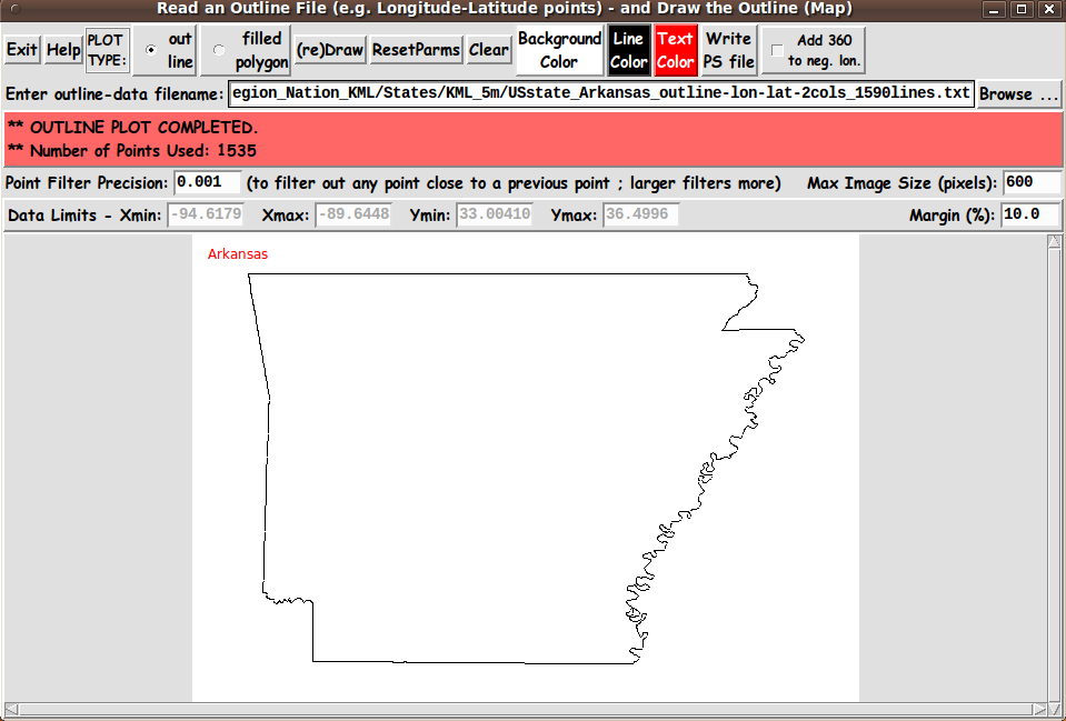
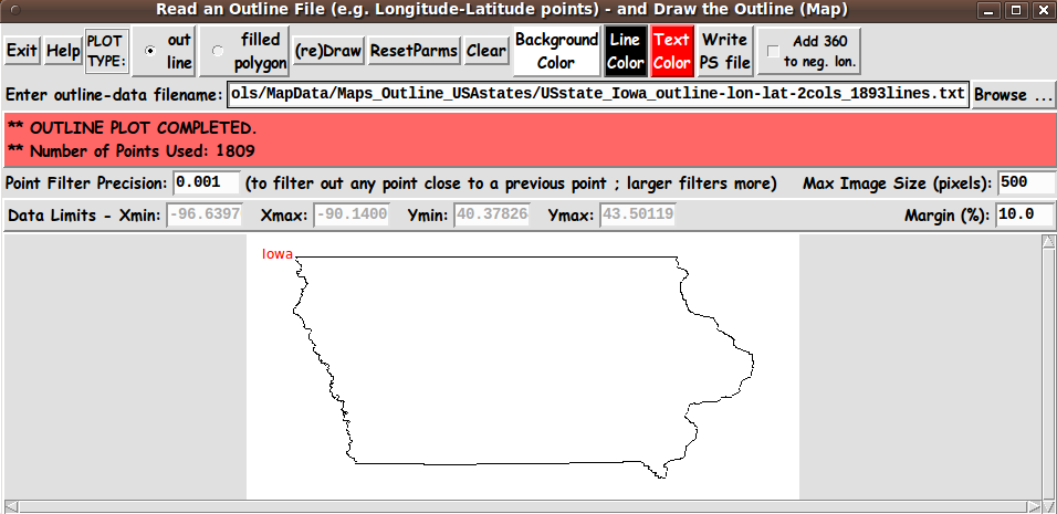
Note that for states whose sides are flat --- like
- Colorado
- New Mexico
- Utah
- Wyoming
very few points are needed to outline the states by
connecting points with straight line segments.
For these states, just 4 corner points (or a few more)
are needed to represent the shape of these states quite
accurately.
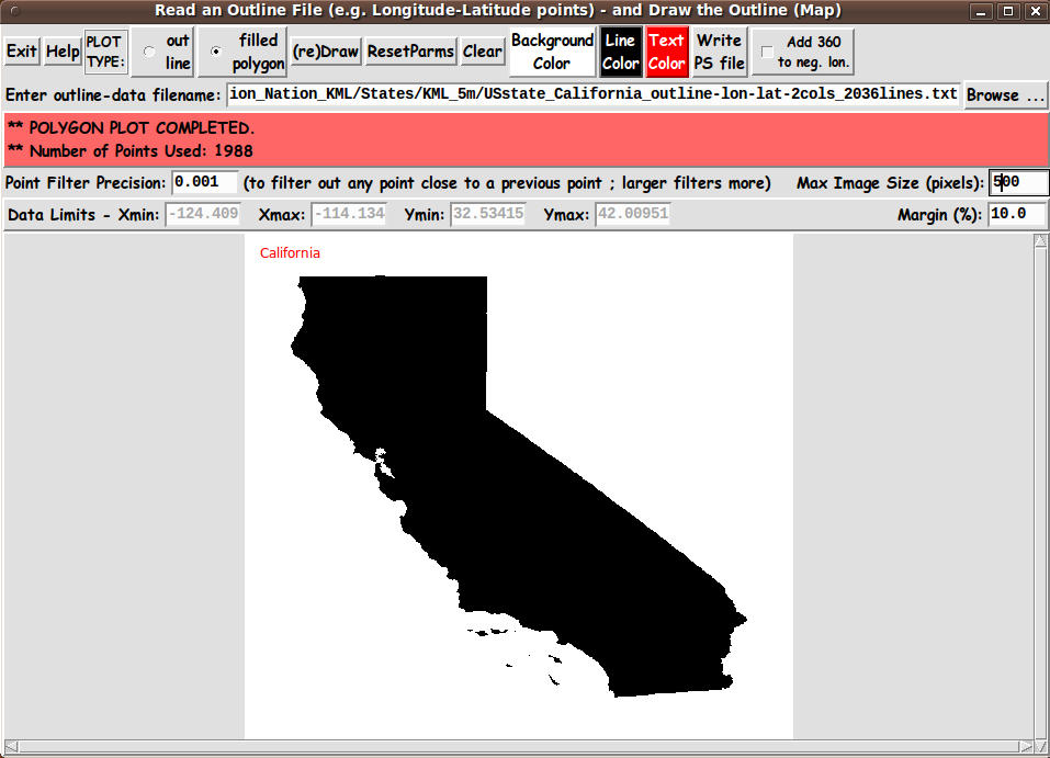
On the other hand, states with ocean or river or
lake boundaries --- states like
- California
- Florida
- Illinois
- Louisiana
- Michigan
- Mississippi
- Oregon
- Virginia
- Washington
will require many more points for a detailed
rendering of the outline of those states.
Generally, about 10,000 points will provide a quite
detailed outline of 'fractal-like' state boundaries
like these.
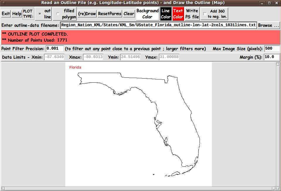
But, if you just want a rough indication of the outline,
a few thousand points --- or several
hundred --- or even less --- may do.
Even for states with 'rough', fractal-like borders --- states
like Florida, Michigan, or Virginia --- about 250 points
will make a quite detailed outline.
Data 'Loops'
Some maps may contain outline 'loops' --- representing
islands --- or bodies of water (like lakes).
The loops are indicated in the data files by a blank or
comment line between sequences of data lines.
A comment line is indicated by a '#' character in column
one of a file line.
Presentation of the files
(How to use these files)
The files (following) are offered in alphabetical order by state name.
The following 'table of contents' (table of links) offers
a way to quickly jump to a section of states starting
with the same first letter.
You can either
-
click on a filename to view a file, or
-
'right-click' on a filename, and, in a popup option
menu, choose an option like
'Save Link Target As ...'.
Some lists of states
Here is a list of the 50 states in alphabetical order.
Here is a list of the 50 states in alphabetical order along with
their centroids (longitude and latitude in decimal degrees).
And
here is a list of the 50 states grouped into regions.
Locations of some 'attractions'
Here is a list of Major League Baseball Stadiums, with their
locations (longitude and latitude, in decimal degrees).
Here is a list of Major League Football Stadiums, with their
locations (longitude and latitude, in decimal degrees).
We may eventually provide a 'MAPtools' 'tkGooie' that can
plot locations like these on a map image --- using markers
and allowing text 'balloons' near the markers.
|